A scientific sensor
sails with us.
Since April 2026, every Echoes crossing between Boulogne-sur-Mer and Dover has also served science. An Ifremer instrument measures the English Channel continuously, without changing a thing on board. Here is why we said yes.
It all started with a conversation between neighbours. In Boulogne-sur-Mer, Ifremer's laboratory and SailLink sit a few metres apart. The conversation came naturally, and the common ground showed up fast. On one side, a boat that links France and England several times a week on a regular route. On the other, scientists looking to measure this stretch of the Channel as often as possible. The fit was obvious.
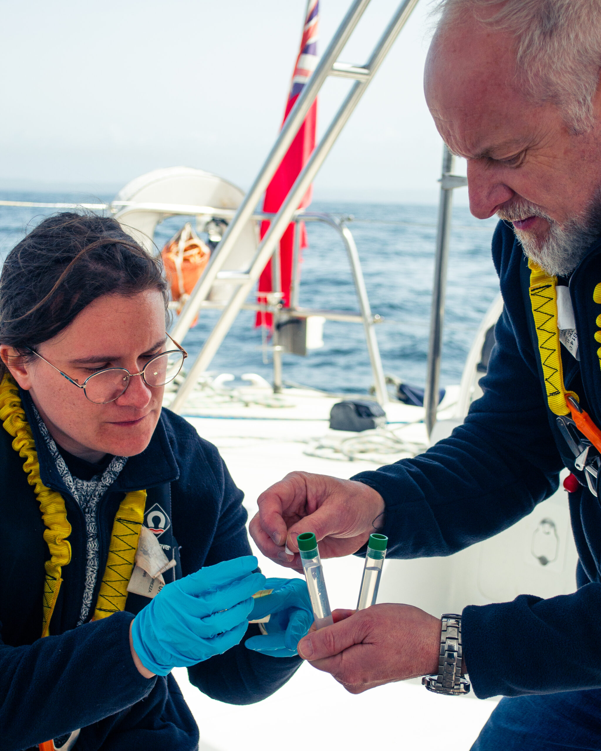
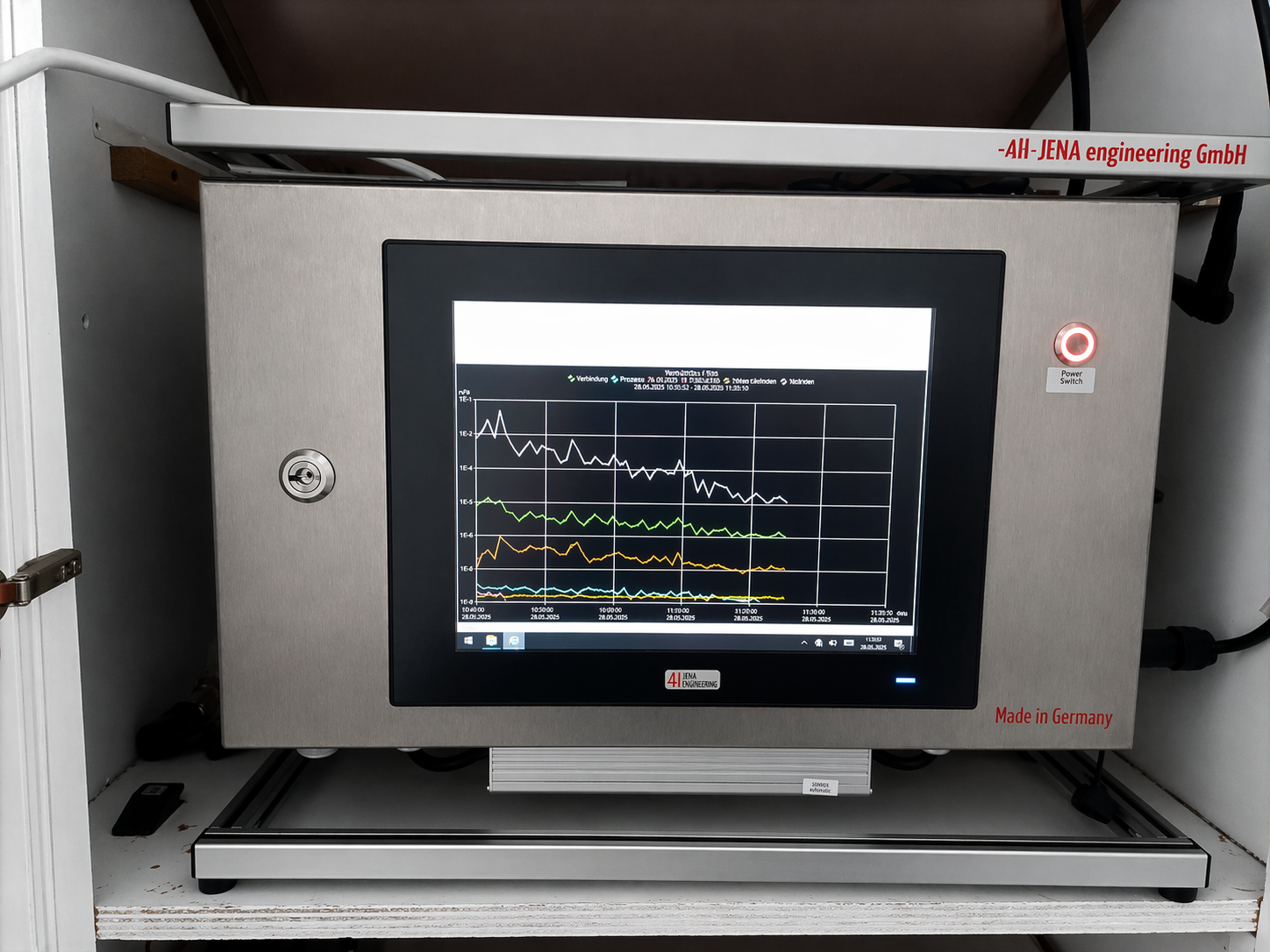
Since 17 April 2026, an instrument called the Pocket FerryBox has been installed aboard Echoes. It measures the water continuously while we sail, roughly every five hundred metres, and sends its readings to Ifremer's Coastal Environment and Resources laboratory in Boulogne-sur-Mer. On every crossing, the device draws a profile of the Channel along our route.
- Instrument Pocket FerryBox, aboard since April 2026
- Frequency one reading roughly every 500 metres, continuously
- Parameters salinity, temperature, dissolved oxygen, water clarity, phytoplankton
- Route tracked Boulogne-sur-Mer ↔ Dover, via Cap Gris-Nez
- Science partner Ifremer Coastal Environment and Resources laboratory, Boulogne-sur-Mer
A shared no-brainer
If we said yes, it is because the arrangement makes sense on both sides: it takes nothing away and gives a great deal. The sensor is invisible to passengers. It changes nothing about our timings, the way we sail or the experience on board. It runs on its own. On our side, we do what we already do, cross the Channel. On theirs, the researchers get reliable data they would not have otherwise, at the real rhythm of a boat that actually runs the link.
It takes nothing away from our crossings, and it gives a great deal to the knowledge of the sea we cross.
For a small outfit like ours, it is a concrete way to be useful to the region. We are not a laboratory and we do not pretend to be. But our hull passes where science needs readings, regularly, across the whole season. Better that the trip serve something larger than itself.
Why this stretch of the Channel matters
The Strait of Dover is not a sea like any other. It takes in the waters of several coastal rivers, the Canche, the Authie and the Somme, which open onto the Channel and feed the environment. That richness lets phytoplankton flourish, sometimes in forms that can affect water quality, shellfish farming or fish spawning grounds. Understanding this water better means protecting everything that lives in it better.
Until now, the area was tracked by monthly sampling and by a fixed station set at the end of the Carnot breakwater in Boulogne. By adding a mobile sensor on a boat that crosses regularly, Ifremer gains something new: a measurement that moves with us, from the coast out to the open sea and from one country to the other. The readings gathered across the 2026 season are now in the hands of the scientists, who are analysing them within the HAPEL and CPER IDEAL research programmes, run with the Marine Nature Park of the Picardy Estuaries and the Sea of Opal.
Travelling differently, and making it count
We like the idea that stepping aboard Echoes is not only a fine crossing. It is also, with no effort and nothing asked of anyone, a small contribution to the knowledge of the sea we cross. Choosing SailLink means trusting another way to link France and England. That this trust also serves the science of our coastline is something we are rather proud of!
Dover ↔ Boulogne-sur-Mer
Cross the Channel under sail.
Twelve seats per crossing, bikes welcome. Be the first to hear the 2027 dates.